
Trace a Hempstead Street Directory
An address and a person are not the same kind of evidence. For a current Hempstead street-by-street inquiry, first identify the parcel and confirm whether the address belongs to the incorporated Village, the Town, or only the Hempstead postal area. The assessment view can connect the address to a parcel. A recorded instrument can then support a title question. Neither source proves present occupancy, and a historical entry only connects an address and a household for the year printed.
- Enter the complete address in the Nassau Land Records Viewer, then retain the returned parcel address, Village or Town label, roll year, and Section-Block-Lot reference.
- Open the parcel map to inspect the street context and adjacent parcels. Record the map date and keep each parcel as a separate result.
- Compare the Section-Block-Lot reference with the Nassau County Clerk index before treating it as an instrument-search key.
- Review the deed image behind a useful index hit, then work backward through the named parties and the document dates.
- For an older address association, consult the library and state directory holdings by edition. The printed year belongs with every conclusion.
The New York voter lookup is not a route for compiling an address list. It is intended for an individual to check that person’s own registration or for election administration, and election-record requests require a truthful elections purpose.
Hempstead Street Directory Search Fields
The Nassau Land Records Viewer, often called LRV, is the practical address start. It exposes parcel fields and street fields together, but its landing form does not show an owner-name field. The form advises searchers to omit directionals and street suffixes, and a partial street name can work. Preserve the address exactly as supplied in research notes, then record the normalized version used in the form.
| LRV field | Field type | Required | Observed format or control |
|---|---|---|---|
| Section, Block, Lot | Parcel identifier | Not indicated | Separate SBL fields |
| House Number | Address number | Not indicated | Enter the street number |
| Name of Street | Street text | Not indicated | Partial name may work; omit directionals and suffixes |
| Town | Jurisdiction | Not indicated | Select or enter the Town context |
| ZIP | Postal filter | Not indicated | Use as a filter, not as a civil-boundary test |
| Captcha | Verification | Yes before search | Search, Clear, and account controls are also shown |
The LRV search form shows the parcel and address controls used for a Hempstead by-address search.
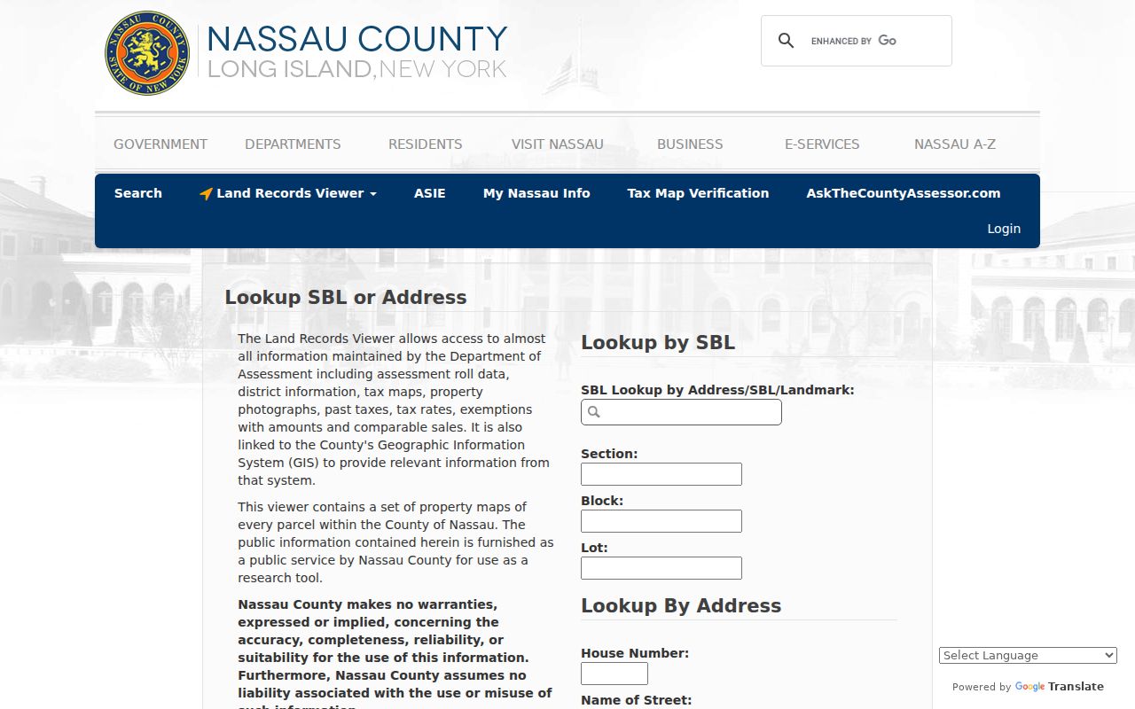
A successful LRV result can expose the address, Village label, tax maps, sketch, archived cards, sales, taxes, rates, and exemptions. The captured public result did not show owner or mailing fields, so do not fill that gap with an assumption. Observed results for 23 Emery Street and 99 Nichols Court showed how Village and district context can appear with parcel material, but each address needs its own fresh result and source date.
Map Hempstead Streets Parcel by Parcel
Use the LRV parcel map after the address form, not as a substitute for it. The map offers parcels, lots, aerial imagery, FEMA and historic basemaps, plus measure and identify tools. It is useful for checking whether a result sits on the intended street and for keeping an adjacent parcel separate from the starting parcel. The ArcGIS parcel layer adds PARCEL, PARID, PARCEL_ADDRESS, ROLL_YEAR, and geometry fields for spatial work.
A parcel is a mapped unit of land. A situs address is the location used to identify that land, and it may differ from a mailing address. A plat is a recorded map or plan tied to land. A criss-cross directory is arranged by address rather than by name, making it useful for a dated historical association. Map geometry does not establish title, occupancy, or a current personal connection.
For a Hempstead street directory search, note the parcel key, address, and roll year before moving to a new result. That simple separation prevents a map neighbor from being treated as part of the same address record. If the parcel map and LRV display do not align, save both source dates and ask Nassau Assessment or the Tax Map Division for the current map context rather than choosing the result that looks closest.
Hempstead Records by Street Address
Address-keyed sources answer different parts of a Hempstead street question. The table keeps each source in its proper lane. Start with the parcel, then move to the custodian that created the next record. A Town result should never be treated as a Village result without checking the jurisdiction.
| Address-keyed source | Custodian | Observed record value | Best access route |
|---|---|---|---|
| Assessment and parcel roll | Nassau Assessment | Address, SBL, district context, tax maps, sales, and assessment detail | LRV |
| Parcel map and layer | Nassau County | Parcel geometry, PARID, parcel address, and roll year | LRV map or ArcGIS layer |
| Recorded land instruments | Nassau County Clerk | Grantor, grantee, document date, book or instrument reference, and map reference | US Land Records and Clerk records |
| Village files and minutes | Village Clerk | Address or parcel in a public agenda, notice, local law, or requested municipal file | Village Clerk or FOIL route |
| Historic directory evidence | Library and state collections | Dated name or business association printed with an address | NY State Library holdings |
Section-Block-Lot, not the street name alone, is the useful bridge between a parcel search and Clerk work. Even then, compare the SBL formatting in the Clerk index with the assessor result before deciding two entries are the same land.
Deeds Along Hempstead Streets
The Nassau County Clerk is the custodian for the official real-property index. Use the current US Land Records route for current recorded material and the historic repository when the chain reaches older material. The historic interface covers 1840 through 1982 and includes deed records, direct and reverse index books, and historic plat-book choices. OCR can miss handwriting, so an empty text search is not a final answer.
Read the document image before calling a link a title conclusion. The county guide notes an electronic database since July 1992, while the historic interface ends at 1982. When a Hempstead parcel trail crosses those boundaries, search the appropriate current and historic routes instead of assuming one interface covers the missing years.
The Clerk accepts land recordings through e-recording, mail, delivery, lobby drop box, or in person. Requests for documents may likewise go by mail, delivery, drop box, or in person. That access choice matters when a searcher needs the instrument image, a certified copy, or help with a document reference the web index does not make clear. Confirm a current charge and payment requirement with the Clerk before requesting a copy.
The Clerk’s Property Fraud Alert is a free email-notification service for documents recorded with a subscriber’s name. It does not prevent a filing and it is not a title search. Direct Clerk channels are also safer than an unsolicited offer to obtain a deed copy.
The Nassau land-record index is the starting screen for the current deed route.
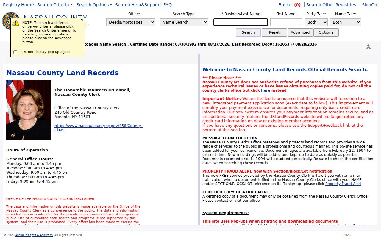
An index entry points to a document. The image, index direction, dates, parcel identifiers, and any map reference should all agree before a deed is used in a street-history note.
Hempstead Address Permit Routes
Municipal files can be useful where an address appears in a notice, application, inspection, agenda, or report. The Village Clerk is the Records Management Officer and Records Access Officer for Village records, including Board material, local legislation, notices, and archives. For older Village material or a record that is not publicly posted, describe the address, date range, department, and desired format in a focused FOIL request.
The Village SmartGov portal is distinct from the Town of Hempstead ViewPoint system. SmartGov publicly offers Public Notices and Reports/Documents, while its account functions concern an account holder’s applications and inspection results. A ViewPoint result belongs to the Town route unless the underlying address and creating agency show otherwise.
In July 2026, an appellate decision discussed the Town’s public permit files and public kiosk as a route for a FOIL requester. That is a reason to check the Town’s records path when the jurisdiction fits, not a reason to label a Town permit as a Village record.
The Village SmartGov public landing page separates public documents from logged-in account functions.
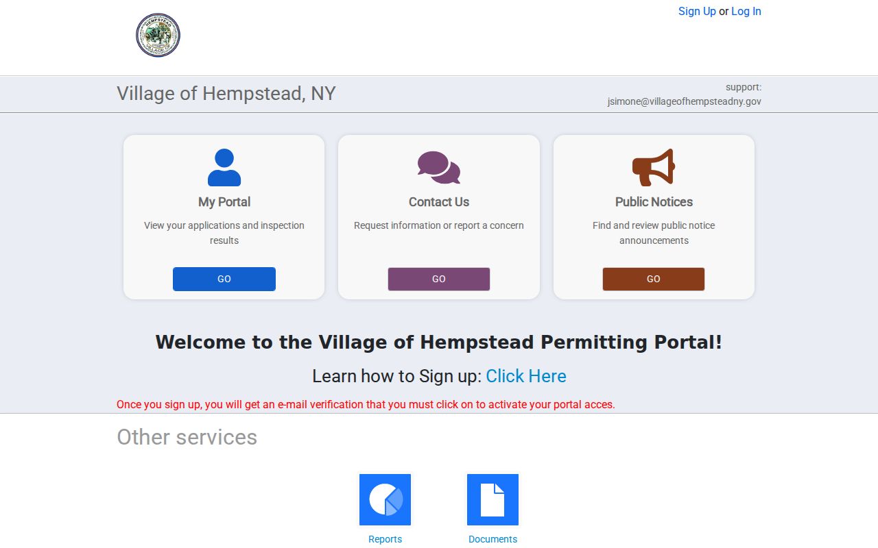
Use the municipal name, address, record type, and date range together. The same Hempstead mailing name can lead to Village, Town, or county custody.
Hempstead Street Names Need Care
“Hempstead” can identify the incorporated Village, the larger Town, a postal city, or a historical locality. A ZIP code is a delivery aid, not proof of municipal jurisdiction. LRV and AROW can help narrow a location, but the final note should retain the exact postal form, Village or Town label, county, SBL, and source date. That record trail is more useful than a broad street-name match.
Older material adds another layer. Street names can change, directory editions can omit an entry, and OCR can fail. No sourced Village street-renaming date was located for use here, so historic research should compare the address, map, directory edition, and recorded instrument rather than invent a conversion. The Hempstead city directory collections are the place to examine the historical shelf in depth. The Town archive holds records reaching back to 1644, but a historical Town source is not automatically a Village record.
Note: A postal-city result may be useful for delivery, but parcel and municipal sources decide which public office created a record.
SBL Tips for Hempstead Streets
Insider tip. Keep the SBL exactly as it appears in each system. LRV’s assessor formatting can differ from the Nassau County Clerk’s official-index formatting, and the difference can matter when a street search returns several similar parcels. The Clerk does not provide ownership information by telephone or email. For a document question, Room B-1 and a well-recorded SBL are the efficient next route.
The AROW assessment search is a useful second address route. It requires a street and ZIP, permits an optional house number and SBL, and uses a city postal name. Its sales locator is informational and limited to one- and two-family comparisons. It does not replace the recorded instrument or turn an assessment entry into a title finding.
Hempstead Street Directory Limits
Such a search can locate an address record, a parcel, a dated document, or a historical printed association. It cannot establish current occupancy from a tax map, water account, parcel geometry, or deed alone. New York restricts DMV personal information, court records can be sealed or confidential, and the voter lookup is not a tool for compiling an address list. A record may be public for a narrow administrative reason without being safe to republish.
Lawful use. Use Hempstead street records for personal, lawful research such as family history, title questions, or civic context. Do not use an address trail to stalk, harass, intimidate, or harm anyone, and do not publish protected or sensitive details.
Hempstead Street Records Custodians
For Village administrative records, begin with the Village directory and the Clerk. For land instruments, use the Nassau County Clerk and review the actual document image. For parcel or tax-map questions, Nassau Assessment is the relevant contact. Historical address work can move to Hempstead Public Library, the Town archive when the Town created the record, and state archive finding aids when local collections do not answer the question.
A careful by-address workflow records the portal, search wording, jurisdiction, identifier, access date, and whether the image was reviewed. It also records the record type, any redaction or access limitation, and the result’s link to the parcel. That makes a later correction possible and keeps a no-hit from becoming a claim that a record never existed.