
Hempstead ZIP Code Coverage
For Hempstead, the safest starting point is 11550, not a claim that every nearby postal label is a Village ZIP. Research found 11550 on Village parcel examples at 23 Emery Street and 99 Nichols Court. It is therefore the strongest initial postal code for an incorporated Village address. Nearby Hempstead service locations and postal designations are useful comparison points, but the research did not establish Village-wide coverage for them. Treat each Hempstead row as a verification route, not as a map of municipal boundaries.
| ZIP | Area treatment | Post office reference | Research note |
|---|---|---|---|
| 11550 | Primary Hempstead postal starting point | Hempstead Post Office | Seen on Village parcel examples; verify each address with postal and civil sources. |
| 11553 | Possible nearby or east-side mailing geography | Uniondale location, 1000 Front Street | Exact incorporated-Village coverage was not established. |
| 11552 | Adjacent West Hempstead postal area | West Hempstead location, 245 Hempstead Avenue | Not confirmed as serving incorporated Village parcels. |
| 11551 | Hempstead post-office box or special-use question | Hempstead postal designation | Residential Village coverage was not established; verify at address level. |
| 11530 | Nearby Garden City comparison | Garden City location | Do not treat this nearby service point as a Village ZIP claim. |
A Hempstead postal city can extend beyond the Village, and a nearby ZIP can be physically close without serving a Village parcel. The ZIP code directory is useful when it keeps those possibilities visible instead of collapsing them into one Hempstead answer.
No official USPS address-level crosswalk for every Hempstead Village parcel was located in the sources reviewed. That Hempstead gap is important. It means the table should not be read as a parcel-by-parcel service list, especially for the nearby codes. Keep each Hempstead post office reference, parcel result, and municipal check together for an address.
Hempstead Postal Starting Point
The USPS Hempstead Post Office listing places the office at 200 Fulton Avenue, Hempstead, NY 11550-3728, with phone 516-560-1120. Published hours are Monday through Friday, 9 to 6; Saturday, 9 to 2:30; and Sunday closed. That Hempstead office listing also identifies nearby West Hempstead, Garden City, and Uniondale locations. It is a good Hempstead source to check current service information, while parcel and municipal sources remain necessary for a Village-location decision.
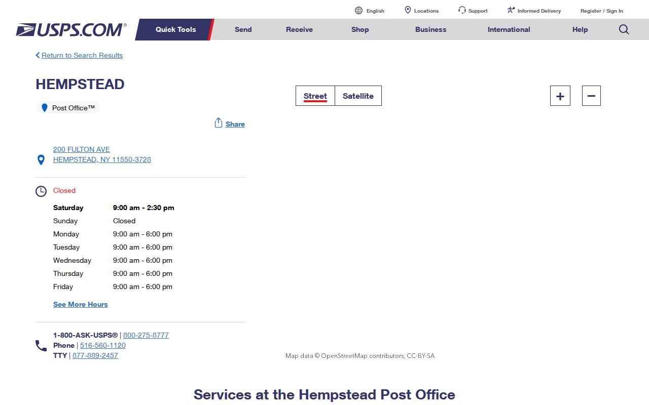
The postal listing anchors the 11550 starting point and shows why nearby post offices should be treated as comparisons, not automatic evidence for Village coverage.
Note: A correct mailing label supports delivery, while an incorporated-Village claim needs a civil source tied to the address.
Hempstead ZIP Filters in Property Records
For a Hempstead address, Nassau's Assessment Review On-line, or AROW, can narrow a search with a postal field. It is an informational assessment search, not a municipal-boundary tool. The captured form requires a street and ZIP code, allows an optional house number, and also accepts an optional Section, Block, and Lot. The City Postal Name field is present on the form. Hempstead search results should be compared with the parcel details and jurisdiction fields before treating an address as part of the incorporated Village.
| AROW field | Type | Required | Use and format |
|---|---|---|---|
| House Number | Text or number | No | Optional address detail. |
| Street | Text | Yes | Required street field. |
| City Postal Name | Text | Not stated | Postal-city field shown on the form. |
| ZIP Code | Number | Yes | Required postal filter. |
| Section / Block / Lot | Parcel identifier | No | Optional SBL locator for a known parcel. |
For Hempstead, the Nassau Land Records Viewer offers a related search using Section, Block, Lot, House Number, Name of Street, Town, ZIP, and a captcha. Its visible form has no owner-name field. A Hempstead ZIP result is one filter among several, so record the Town and SBL as well as the postal value.
AROW also has a sales locator for one- and two-family property comparisons in Hempstead. The research describes it as informational, not an appraisal. Its radius, building-size, date, land-footage, and maximum-five-comparables controls can help inspect Hempstead parcel context, but they do not settle title, occupancy, or municipal boundaries. The County Clerk's records remain the source for recorded land instruments.
The AROW property-search form shows the ZIP, street, house-number, and SBL fields in one place.
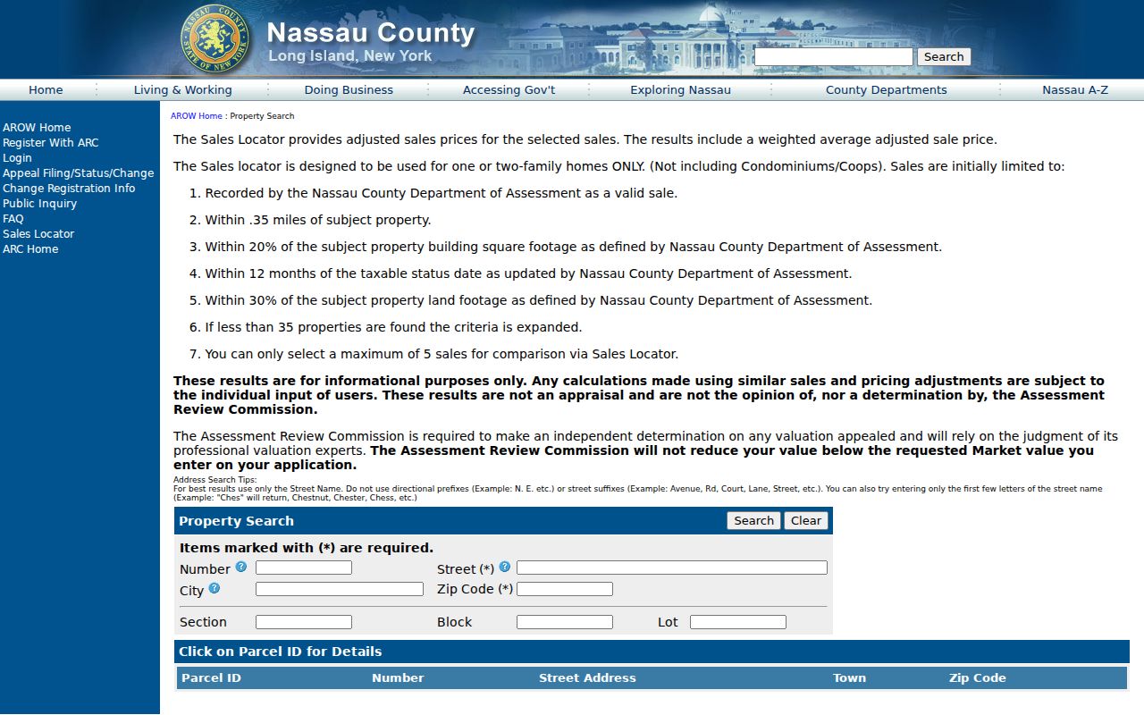
The form is most useful after the postal address has been checked, when its result can be compared with the specific parcel rather than used as a broad ZIP list.
Search a Hempstead ZIP Code
A Hempstead ZIP-based search is an address-verification workflow, not a way to identify a whole community. Begin each Hempstead search with the exact mailing address, then add the parcel and jurisdiction details. The public voter-registration lookup is intended for an individual's own status and asks for name, date of birth, county, and address information. It is not a Hempstead ZIP directory. New York voter-file requests have an elections-purpose limit, so a Hempstead postal search should stay with the official address and property tools described here.
- Confirm the mailing address and ZIP with USPS, including the full ZIP+4 when it is available.
- Use the street and ZIP in AROW, adding the house number or SBL when known.
- Compare the result with the Nassau Land Records Viewer, recording the Town and parcel identifier shown there.
- Check the incorporated municipality with the responsible Village or Town source before making a location claim.
- When the work becomes street-specific, use the Hempstead by-street directory for the separate address-record path.
For Hempstead, this sequence makes the uncertain part visible. It also preserves a path to repeat the search if the postal code, street spelling, or municipal field changes.
Hempstead Postal Address Checks
For Hempstead mail, USPS Publication 28 provides the form “MR JOHN DOE / 123 MAGNOLIA ST / HEMPSTEAD NY 11550-1234.” Use that convention when recording a mailing address, including the ZIP+4 when it is supplied. Postal formatting improves delivery and makes the same Hempstead address easier to search across systems. It does not decide whether the property is in the incorporated Village, the Town, a school district, or another local boundary.
A Hempstead ZIP filter can return addresses outside the Village, and an address carrying a Hempstead postal city can be outside the Village too. The Hempstead difference is common enough that a full postal label should never be the only location evidence.
Hempstead ZIP Code Boundaries
USPS ZIP codes used with Hempstead addresses are delivery constructs. They do not equal Village, Town, county, school, tax, or election boundaries. This is the key Hempstead mismatch: a result with a familiar postal city or 11550 may still need civil verification, while 11552, 11553, 11551, and 11530 cannot be promoted to Village-wide coverage from the evidence reviewed. Use a Hempstead Village directory or parcel jurisdiction field for government geography, and use USPS for the mailing address.
- ZIP
- A delivery-routing code used in a mailing address. It is not a municipal boundary.
- ZIP+4
- The extra four digits that refine delivery routing for a specific address or part of a delivery route.
- Post-office-box ZIP
- A postal designation associated with box or special delivery service. It does not establish residential parcel coverage.
- Unique ZIP
- A ZIP assigned to one organization or institution. None is established as a Village-wide code by the research here.
- Carrier route
- A postal delivery grouping used to organize mail. It is not a substitute for a parcel or municipal boundary.
Hempstead postal information also has a privacy boundary. A five-digit ZIP is not permission to reconstruct a protected address or to publish sensitive identifying data. When a Hempstead address is protected or a record is restricted, use the responsible agency's process rather than attempting to resolve it through surrounding postal or parcel details.
Note: Verify delivery with USPS, then verify municipal geography with the Village, Town, County, or parcel source that controls it.
Hempstead ZIP Evidence Layers
Hempstead's dense local geography makes a layered record more reliable. The Hempstead Village has overlapping Town, County, postal, school, fire, and assessment contexts, so “nearby” is not enough. The Nassau parcel map can provide Hempstead geometry and an address, while the Land Records Viewer adds assessment and parcel context. Neither source is a title document. For a current Hempstead map view, the Nassau ArcGIS parcel viewer offers the parcel-layer context that can be checked against the property search.
Write down whether a Hempstead result came from USPS, AROW, the Land Records Viewer, ArcGIS, the Village, or the Town. That Hempstead source label explains what the result can prove and prevents a mailing value from being mistaken for a jurisdictional finding.
Hempstead ZIP Mismatch Checks
Before relying on a Hempstead postal result, compare the street number, street spelling, postal city, ZIP, Town, incorporated municipality, and SBL. Check the Hempstead source date too. If no matching parcel appears, try an alternate street suffix, a shortened street name, or the SBL rather than assuming the address is absent. The Land Records Viewer notes that directional words and suffixes can affect Hempstead street searches, and partial street searches may work.
This Hempstead postal reference is strongest when it records uncertainty plainly. For 11553, 11552, 11551, and 11530, the research supports comparison or address-level checking, not a Village-wide statement. That restraint helps keep Hempstead property, archive, family-history, and civic research tied to the right Hempstead jurisdiction.
A Hempstead no-hit is a reason to test the search, not a finding that an address does not exist. Recheck the postal format, remove a directional or suffix in the viewer, search a partial Hempstead street when appropriate, and compare the parcel identifier with the Nassau Clerk's records if the question concerns a recorded instrument. Preserve the negative result as “not located in this source and date range” so the next searcher knows what was actually checked.
Note: Save the exact URL, search fields, jurisdiction selected, date, result type, and any access limitation with each address check.